Two North American Buddhist Communities Who Welcome Travelers along the Way
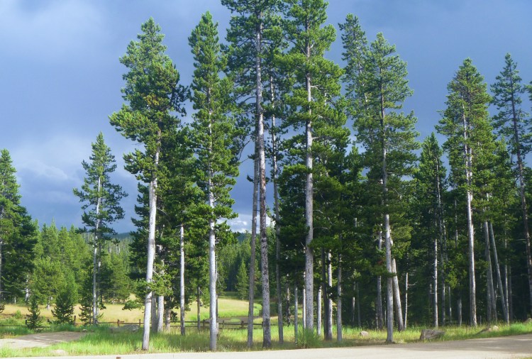
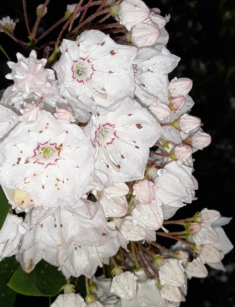
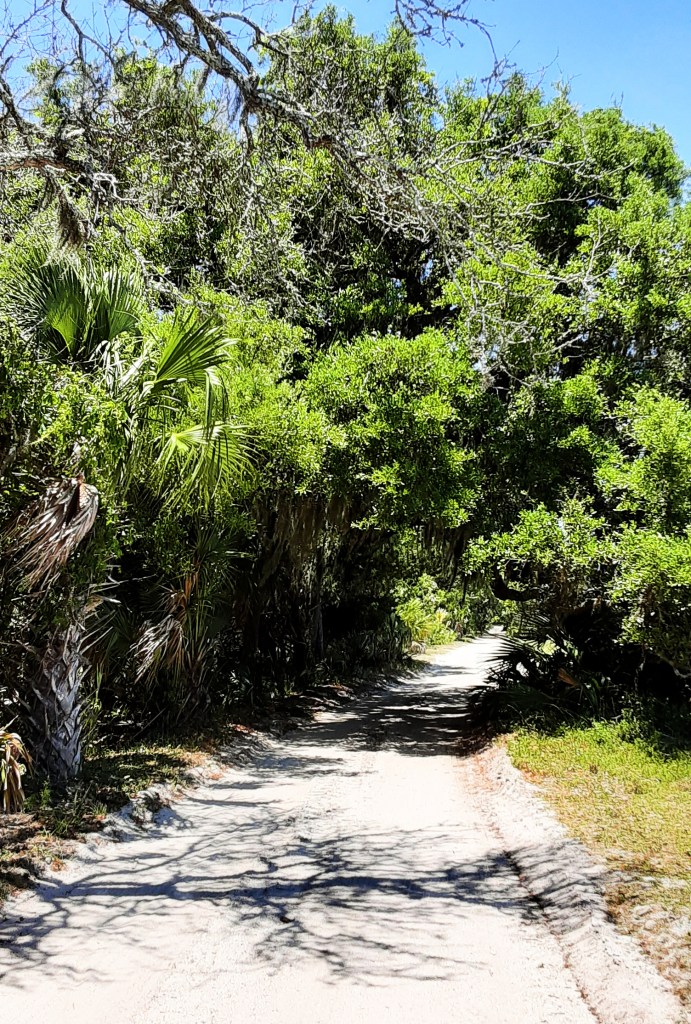
Chagdud Gonpa Rigdzin Ling is nestled in the remote Trinity Alps of Northern California. It’s a jewel hidden behind the Trinity River and Highway 299 deep in the Trinity National Forest whose name means, “the abode of the Awakened State Holders.” The site is a Buddhist educational center for retreats, ceremonies, meditations, practice groups, and Padma Publishing.
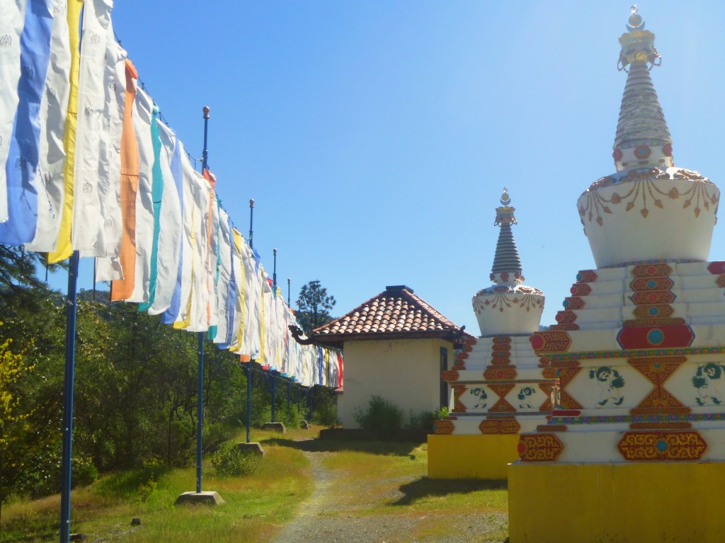
A path through the Eight Great Stupas.
Overnight visitors who respect the space are welcome. To respect the space means to refrain from alcohol, cannabis, tobacco, amplified sound, loud voices, and speaking at all while in the Tara House or Prayer Wheel House. Come on, people are trying to meditate. If that all sounds reasonable, you have several lodging options. Budget travelers can choose from tent camping or what is called indoor camping. Indoor camping is sleeping in a shared space like a lodge or the yurt with others. All travelers must bring our own bedding.
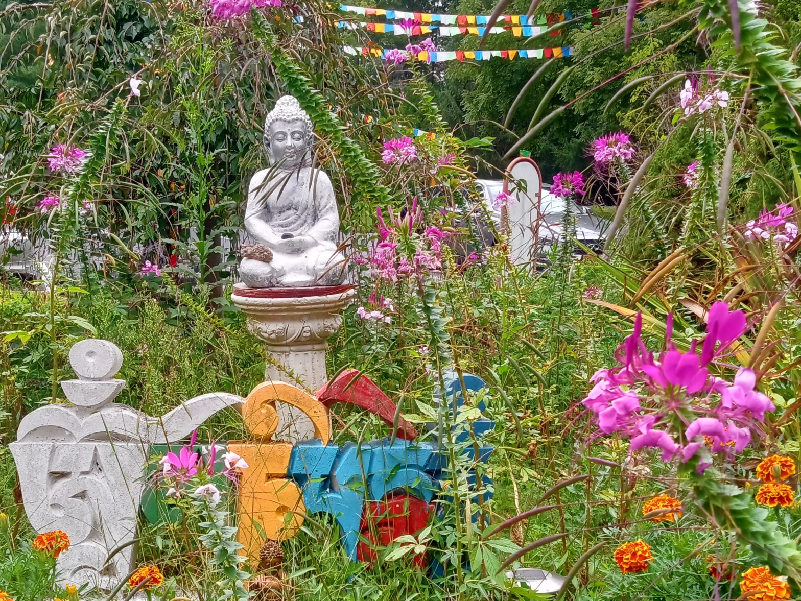
The Padmasambhava statue, representing Enlightened Body.
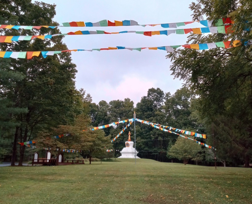
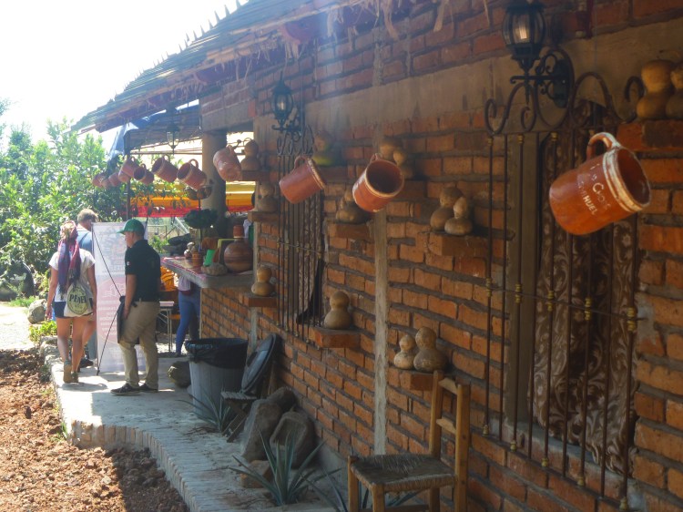
Listen for the whistle of the Prayer Wheel House. The spinning of fifteen giant wheels whisks the energy of 10 million Vajrasattva mantras into the clear mountain air, and returns to humanity as an experience of purification. Rigdzin Ling’s founder, Chagdud Tulku Rinpoche, commissioned the Prayer Wheel House after his mother passed away when he was eleven years old. He had been on retreat when it happened, and he declared that her assets be used to construct the space so that “all who come there and pray with would be cleansed of obscuring habits and poisons of the mind.”
The Prayer Wheel House at Chagdud Bonpa Rigdzin Ling.
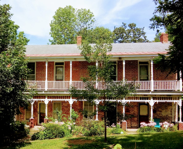
The Tibetan Mongolian Buddhist Cultural Center outside of Bloomington, Indiana, is a centrally located doorway into Eastern thought from the comfort of the American midwest. It was originally established in 1979 to preserve Buddhist traditions among the Tibetans and Mongolians in exile from Communist regimes, and since has expanded its scope to foster peace, harmony, and cultural exchange.
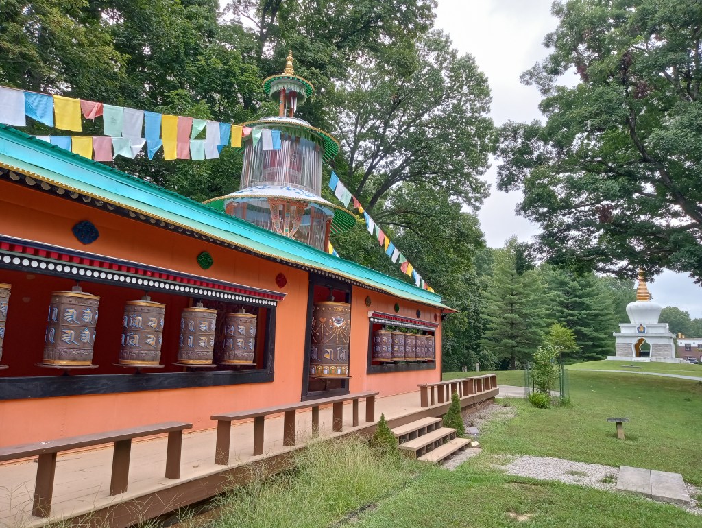
The Prayer Wheel House at the Tibetan Mongolian Cultural Center.
In 2005, the Dalai Lama invited the Chinese Buddhist monk asylum-seeker Arjia Rinpoche to relocate from Mill Valley, California, to Bloomington, Indiana, to direct the center since the founder was approaching an older age. Arjia Rinpoche accepted the request and he is the current Abbot. Like Chagdud Tulku Rinpoche, Arjia Rinpoche is a “tulku,” or someone recognized from a young age to be the reincarnated being of a previous holy person. These individuals are on the Bodhisattva path, and the belief is that they chose to return to Earth as ascended masters who joyfully accept the human experience of suffering to fulfill their Dharma, their spiritual purpose.
Prayer flags printed with mantras inspire positivity, wealth, and health.
Look for the brightly colored prayer flags. Each individual flag is printed with the wind horse symbol and mantras for positivity of mind, wealth of spirit, and health of body. The colors also have meaning. Blue is sky, white is air, red is fire, green is water, and yellow is earth; together, they represent balance. As they fray and whither in the sun and the weather, the fabric unravels and the energy of the mantras is spread over the land. The threads travel and depart from their experience as a flag, but leave behind a profound meaning of a path that is accepted and followed.
When I arrived in Krakow from Prague, it was late May, pouring rain, and very dark. I had layered practically every item of clothing onto my shivering self, to no avail from the damp. I was only in the city for two nights, and although I wanted to cocoon myself in blankets and bask in the inviting den of the hostel, I knew I would probably regret that decision. With the intention of life on the tip of my tongue, I bundled up in sweater tights, jeans, a knee length dress, a long sleeve t-shirt, a hoodie, and a woven hat, and ventured out into the radiant city, which glistened with street lights shimmering dimly in the puddles.
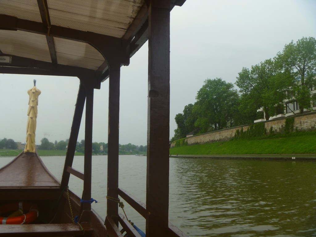
My fellow passengers on the boat tour had all canceled. They must have stayed in bed, and with rain that blew sideways across the river, I can’t blame them. In a small boat with a dragon at the helm, I was guided on a private river tour of the City of Krakow. A cassette tape explained the landmarks and history, but it wasn’t in sync with the flow of the water, and at times, the speaker was abruptly cut off and replaced with bits of a Bob Marley song, as if someone had accidentally recorded over the original content.
The dragon at the helm guided me through Krakow along the Vistula River.
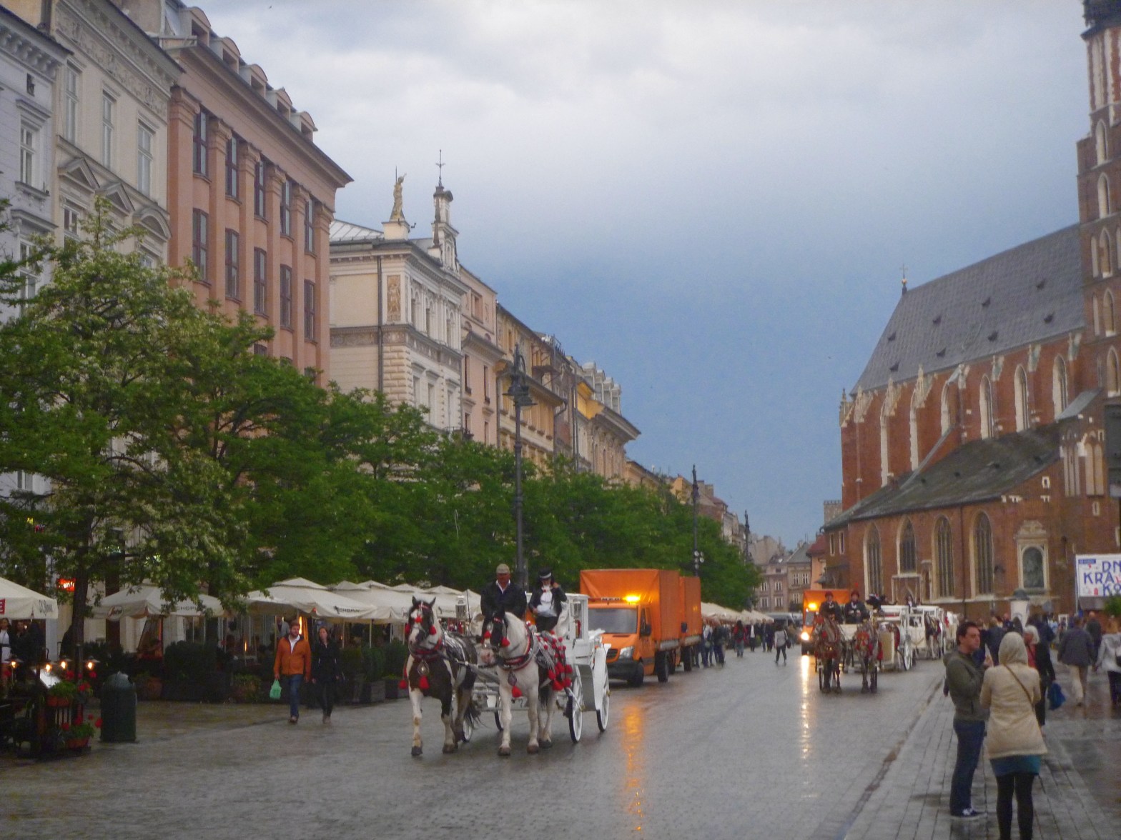
The boat experience ended, and I drifted to the Rynek Glowny, the Main Square in the Old Town, to find a warm beverage and maybe some heat. Rynek Glowny is renowned in the Project for Public Spaces as the best public place in Europe. It is a centuries-old market square, and what exists today had been rebuilt in 1257 after a Mongol invasion destroyed the city. Although some of it was also destroyed during the German Nazi occupation of WWII, most of it was spared. Today Rynek Glowny is lively with cafes, foot traffic, bars, vendors selling amber jewelry and sheep fur pelts, street musicians, and guides waving English, Italian, and Spanish flags to indicate to tourists the languages they speak.
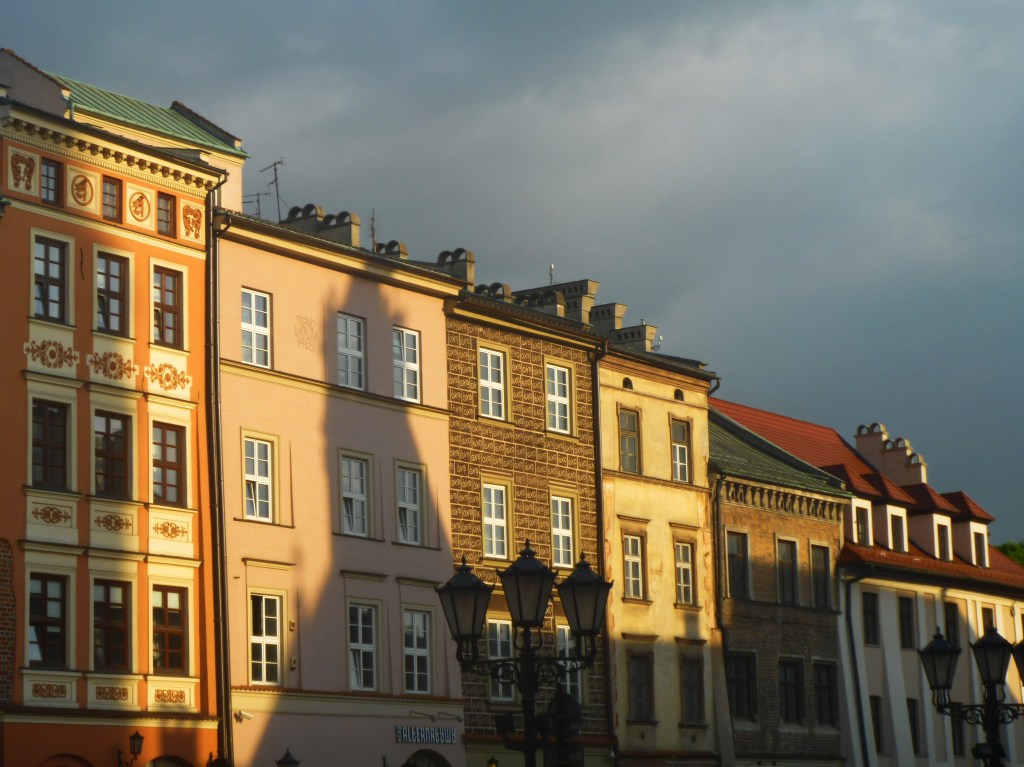
Shadows over buildings at Rynek Glowny.
I had booked a Polish Food Tour to introduce me to traditional Polish jedzenie. With a couple of hours to spare before the rendezvous, I settled in beside an outdoor heater at a street cafe and ordered a German coffee, a decadent cocktail with Kirschwasser, coffee, and whipped cream. A flow of pedestrians, shoppers, and tourists meandered through the cafes and kiosks, and although it was only late afternoon, dusk was already settling.
Tourists and shoppers meander the city streets.
Feeling a bit warmer, I wandered to the other side of the main square to meet my tour group. A man named Peter held a British flag to indicate English, and for three hours, ten of us followed him through the Old Town as he introduced us to his country’s traditional food.
Peter at Stary Kleparz, the oldest operating market in Krakow.
From the main square, we walked a short distance to Stary Kleparz, the oldest operating marketplace in Krakow. For seven centuries, Krakovians and visitors have been buying sausages, cheeses, fermented cucumbers and cabbages, fresh fish, and supplies of endless herbs and dills marinating in glass jars. Kleparz is a derivation of the word klepac, meaning “to bargain.” Peter guided us directly to a stall selling sausage and some type of dried cheese. The spices warmed me a bit.
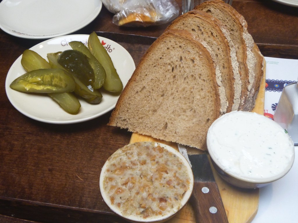
Next, we went to a restaurant that served us a full meal. We drank tea sweetened with plum and pears; and ate dense rye bread with lard and pickles, creamy and salty pig belly soup, and of course some type of dumpling with potato. Imagine the time, effort, and planning needed to prepare a meal of this variety for a family of twelve!
Rye bread, pickles, lard, and dill sauce.
After that meal, I wanted a five mile walk, but instead we waddled three blocks to a bakery. Peter said it was the bakery where his father and mother met before they were married. Inside, we ate kremowka, a layered cream pie, filled with whipped cream, buttercream, and custard cream. Our last stop was a distillery with flavored vodka. My flavor was honey. Zachwycajacy. Entrancing.
Kremowka from the bakery where Peter’s parents had met.
With my head, heart, and stomach full of warmth and food, I wandered back to Rynek Glowny and to a kiosk that sold Baltic amber harvested from the Gdansk coastline. 40 million years ago, the Baltic Sea had been a forest of resin-producing trees like pine and sequoia. The beautiful gem of amber is formed from hardened tree sap, and it washes onto Poland’s beaches after a storm. A necklace of amber set in leaf-petal shaped silver charms had caught my eye. Amber is polished and made smooth from the movement of the Baltic Sea. Like our own lives, it is molded through a gentle ebb and flow. My jeans were damp up to my knees, and I shivered as a wind pushed against me in the dark night.
We flopped onto a park bench in the Plaza de la Liberacion. We had been wandering up and down the Avenue Miguel Hidalgo y Costilla for hours, and were dehydrated, famished, and frustrated with each other. The map we had picked up at the hostel refused to match in either scale or street name with the city in front of us, no matter how many times we pulled it from each other’s hands (let me see!) and turned it upside-down or sideways. Earlier that day, we thought we had gotten on the correct bus only to find ourselves at the end of the line in a village far away from the Zona Centro and the Catedral de Guadalajara, our primary landmark. The city’s dust had aggravated the exposed skin of my ankles, and they were red and inflamed, as if I had been wading through fiberglass. We had wanted to find Teuchitlan Guachimontones, but one entire day of our short three day adventure in Guadalajara was already over, and we had given it all to being lost.
The sun was painfully brilliant while we rested in the Plaza de la Liberacion and waited for something to change.
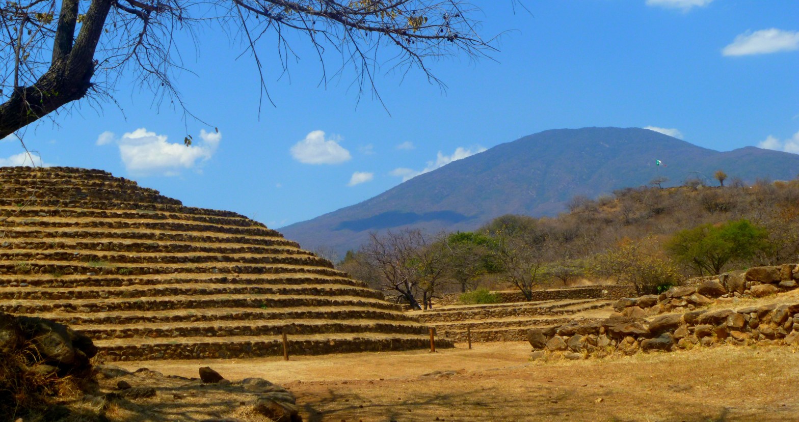
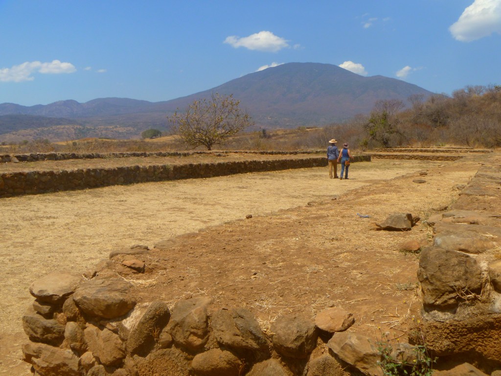
Los Guachimontones are what remains of an ancient civilization located in the hills above Teuchitlan in the Mexico’s Tequila Valley. It is the largest pre-Columbian archaeological site in the province of Jalisco. It is a fairly new discovery as far as the field of archaeology is concerned, and the site has experienced heavy looting. For this reason, it was added to the 100 Most Endangered Sites on the UNESCO World Heritage List in 2008. We only found our way to the site through an act of cosmic alignment. I had a dream about the place, and we both followed the call onto a plane, because at that moment, we were supporting each other’s dreams, and the more spontaneous, the more intriguing.
We drifted in solemn, sullen, and exhausted silence back to the hostel and after a quick dinner of empanadas, I went to the women’s bunk room to sleep. I had decided that whatever experience we had together was the purpose, ancient civilization or not. The next morning, my traveling companion was already awake with coffee on the outdoor patio. On his face was a confident and knowing smirk, and he explained to me that after I went to sleep, he got to talking and it turns out that the host of the hostel is actually from Teuchitlan, and he was pleased to hear that we were in Guadalajara to see Los Guachimontones. To add to the fun, a group of five German tourists overheard the conversation, and having never heard of this archeological site, of course they wanted to join us.
The outdoor patio at the Santa Maria de Guadalupe hostel in the Centro Barranquitas district of Guadalajara.
So the seven of us followed the guide to the bus station and we rode through a barren and dusty desert until it was our stop at the village of Teuchitlan. We followed our guide through the village, pausing at a beverage bar that sold creamy drinks of fermented corn that people believe have healing properties. Some of them included lime and were served over ice, some appeared in mugs and were served hot. The guide encouraged us to sip the beverage, explaining it would help with the abrupt change in elevation we were about to experience.
We stopped for ceremonial beverages made from fermented corn and lime.
The site was clearly very new. Many of the areas were still under excavation. Archaeologists have unearthed one large circular pyramid, nestled around several smaller pyramids. The pyramids are actually shaped like a bulls-eye, with several distinct elements that comprise an entire structure. Researchers have also discovered what appears to be a large, rectangular area that they speculate was a field for playing games. A mural inside the Visitor’s Center (under construction) depicts a shaman dressed as a bird and flying tethered to a pole, using the area for his ceremonial magic.
A couple walks hand in hand through the newly excavated archaeological site.
I still don’t know how or why exactly I ended up in Guadalajara for a weekend to witness an ancient civilization unearthed after centuries buried. My traveling companion believed that the site, among other portals on Earth, vibrates healing energetic frequencies, and perhaps that is true. Any journey into the unknown gives healing, if we are willing to follow our intuition more closely than our maps and turn off our phones long enough to listen. Growth, like traveling, like healing, is a process, and the journey to the destination may look different from what we might have expected.
The silhouette of our unofficial guide whose moments intersected with ours long enough to facilitate an experience that could never have been fully planned nor could have existed on any map.
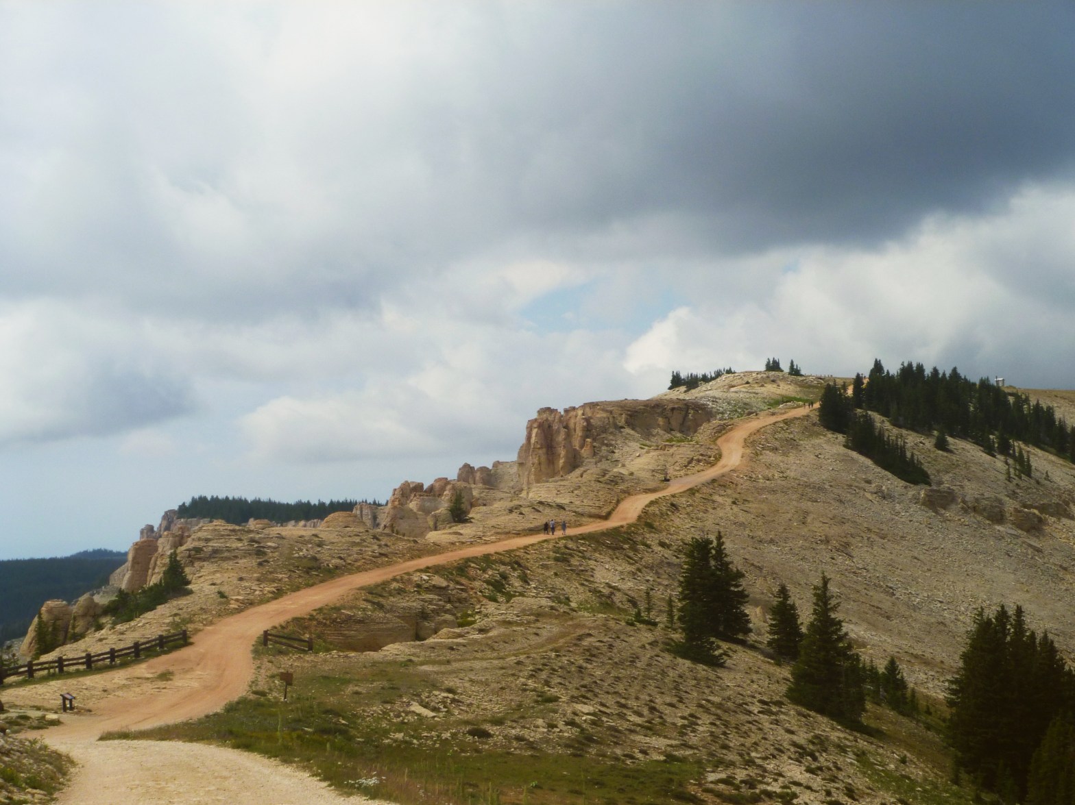
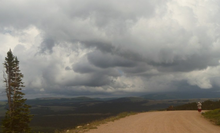
On the 28th day of July, at the full moon in Aquarius, I drove into the mountains of the Bighorn National Forest, searching for the medicine wheel. Located at around 10,000 feet in elevation, the medicine wheel and the Forest Service road leading to the Medicine Mountain Trail, is obscured with snow for most of the year. Even on this late day in the summer, heavy clouds threatened overhead, and a chilly wind dropped the temperature down to 44 degrees.
A summer storm gathers in the Bighorn National Forest of Wyoming.
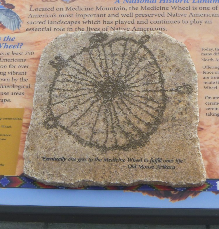
It is significant that I searched for this sacred site on the 28th day of a month, in respect to the power of the number 28. The medicine wheel has 28 spokes, as does the lunar cycle. According to Toltec shaman Don Jose Ruiz in his book The Medicine Bag: Shamanic Rituals & Ceremonies for Personal Transformation, the medicine wheel is and “has always been an integral part of spiritual life. It contains the cardinal directions of north, south, east, and west … In this way, the medicine wheel is a physical object represented in symbolic artwork, and the image of the wheel is built into landmarks at sacred locations, which are often meeting places for communal ceremonies and rites.” In Western thought, the 28th day of July marks the successive rise of the star Rigel first, and then Sirius 28 days later. Furthermore, the full moon in Aquarius represents a connection to the future, non-attachment, and visionary ideas. I was ready to connect to a spirit map in search of my inner cardinal directions, my own north.
With my belongings loaded into my fuel-efficient Ford Fiesta, I had left my days of basking in the Nor Cal sun on the banks of the free-flowing mountain rivers behind me, and my inner-eyes sought only for how a new vision and future could unfold. I searched for the medicine wheel to walk its spokes and in those movements, to align my personal energetic life power with the intentions and inspirations that would blaze my path forward from here.
Although I had written directions to the trail on a page of my journal and had lodged the torn sheet in the console of my car between several CDs and my bottle of water, the trail head proved difficult to find. I continued to gain elevation while my tiny car protested the steady climb. I almost turned around, concerned that perhaps I had passed it, but felt a pull to keep going. Intuitively, I knew I was on the correct road and that what I searched for was still up ahead if I kept driving.
Nearly 50 miles from the turn onto Wyoming’s Highway 14A, I finally found the trail head. From this point, it was a 1.5 mile hike to the wheel. A Forest Service ranger gave a quick warning to bundle into a sweater, to stay on the trail that protects the fragile tundra vegetation from being trampled, and to respect the cultural artifacts and sacred objects that surround the wheel. The hike up the mountain took about half an hour. I shared the trail with very few people, and it was pretty much only myself along with a handful of indigenous people who protect the wheel as their heritage.
“Eventually one gets to the Medicine Wheel to fulfill one’s life.” Old Mouse, Arikara
At the base of the wheel, a stone depicts a quotation from Old Mouse, a member of the Arikara people, stating that, “eventually one gets to the medicine wheel to fulfill one’s life.” Here I was, at the medicine wheel, pursuing the question of where my life would go from here; the answer, I knew, was waiting quietly for me to find it. It is in the process of the movement of the body, and in the rhythm of the breath, that those inner secrets are set ajar and unearthed from their hidden places to reveal themselves.
As I hiked back to my car, I passed another woman hiking alone. I had seen her earlier. With her bright red ankle length skirt and a scarf over her head, she stood out against the others of us walking in our jeans and sweaters. She also carried a hand woven basket, and at closer glance, I noticed that inside was a jar of water and a loaf of bread wrapped in cloth. She stopped me on the path and asked that I take her picture. Assertively, she directed me through the location, frame, angle, lighting, and even the theme. “Little person, big world,” she said with a Russian accent. Through a quick dialogue, I learned that she lived in Ranchester, Wyoming, but was from Russia. Ranchester is a village between the remote boundary of the Bighorn National Forest and Sheridan, Wyoming. I wondered why she had come from a remote Russian village to a remote American village? Perhaps, like myself, she had hiked up Medicine Mountain to find herself at the center of four cardinal directions.
The trail was a journey of solitude. As the dark clouds threatened lightning, I hurried back to my car and met a Russian woman who carried water in a glass jar and fresh bread wrapped in a cloth.
At some point in my life, I decided that the two most important American institutions are the library system and the protected wilderness areas; access to knowledge and nature are necessary democratic concepts. The United States, or Turtle Island as the landmass is named among First Nation people and non-indigenous activists, currently has 63 National Parks and 154 National Forests. The difference between Parks and Forests is that Forests are protected for mixed use like timber, grazing, fishing, and recreation; while Parks are preserved in their natural state of ecological existence. The Western states like California, Alaska, Oregon, and Idaho are well-known for their expansive playgrounds of mountains and trees, and rightfully so because those Humboldt Redwoods are my favorite 300-foot tall beings I’ve met on the planet. But the eastern ecosystems deserve a shout out too, and here are three (in no particular order) totally worth exploring.
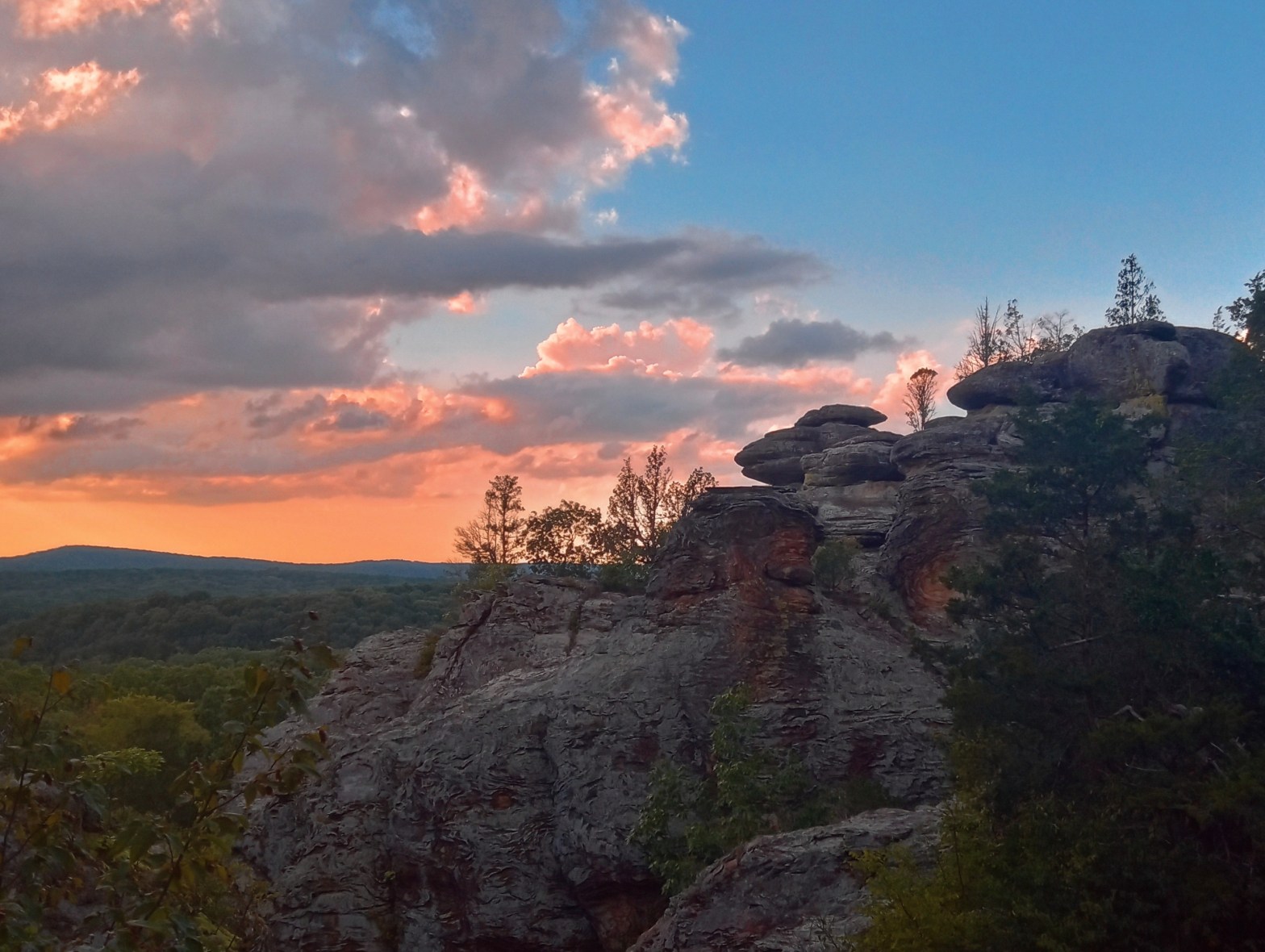
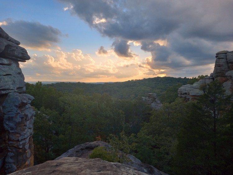
Shawnee National Forest: Stunning Vistas in Sasquatch’s Summer Home
Sunset vista at Garden of the Gods overlooking Shawnee National Forest wilderness.
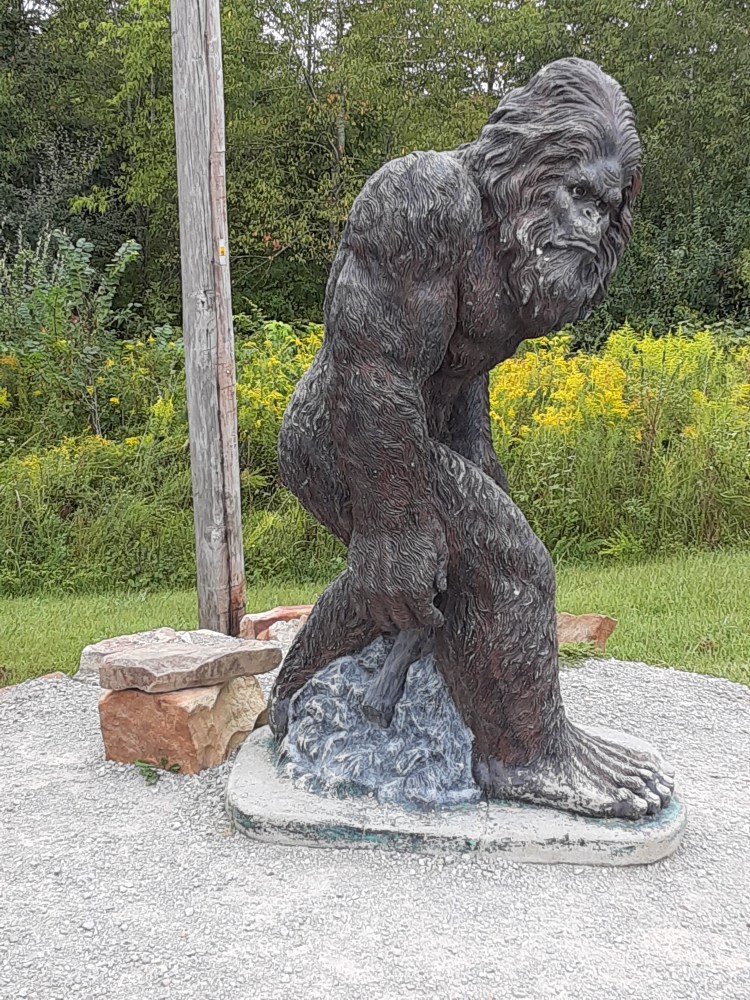
This rural and rugged wilderness oasis is located in southern Illinois, nestled between the Ohio River and the Mississippi River. It’s 451 square miles of oak-hickory forest, flourishing wetlands, steep canyons, stunning vistas, and Sasquatch sightings. Two of the most impressive features are the Garden of the Gods Wilderness Area, and the 160 mile long River to River Trail which forms the southern section of the American Discovery Trail. The Shawnee National Forest has quickly topped my list of checkpoints on any camping road trip. Off grid and primitive, Pharoah Campground is a short walk to the Observation Trail through the Garden of the Gods, and Pounds Hollow offers a pristine freshwater lake for a refreshing swim and trail access to Window Rock. Definitely make a stop at the Garden of the Gods Outpost for firewood, a selfie with Sassy Sasquatch, and supplies; you won’t find other stores nearby.
Sassy Sasquatch, Bigfoot’s social sister, who hangs out in front of the Garden of the Gods Outpost near Herod, Illinois.
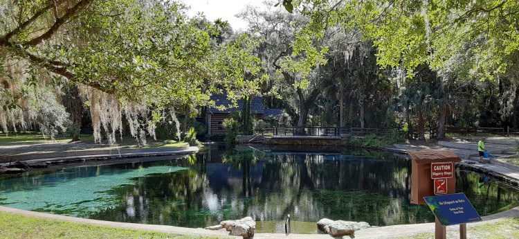
Ocala National Forest: Mineral Springs and Manatees
Early morning at Juniper Springs in the Ocala National Forest.
The Ocala National Forest in central Florida protects the world’s largest Sand Pine forest. As if that weren’t cool enough, the area also has over 600 lakes, rivers, and springs cascading across the sandy plane, and it is in these waters that Florida’s remaining 6300 manatees migrate for the winter. Let me tell you about these springs: crystal clear, shimmering with eel grass, and forever hovering between 72 and 74 degrees. These springs emerge from underground limestone caves, and the water is soothingly cool and fresh. Fresh water swimming, especially in cool spring water, has many documented physical and mental health benefits like stimulating blood circulation, releasing endorphins, and boosting the immune system. One of the springs and my personal favorite is Salt Springs. It pools from deep enough underground that the water is slightly saline with minerals of sodium, potassium, and magnesium, and has been known to reduce inflammation and pain in the body. The springs are all developed so you’ll find the human infrastructure we all enjoy, like picnic areas, facilities, accessible walking trails, and parking lots.
Salt Springs in the Ocala National Forest.
Chattahoochee-Oconee National Forest: Waterfalls and Rhododendrons
Rhododendrons along Frogtown Creek in the Desoto Falls Recreation Area of the Chattahoochee-Oconee National Forest.
Although this merger of two forests (the Chattahoochee and the Oconee) are located in Georgia, don’t make the same mistake I did and assume it will be warm. It was here in these Blue Ridge Mountains and among the dense forest of evergreens that I camped through pouring rain that evolved into heavy hail as twilight descended into darkness. After digging a shallow moat around my tent to channel the water away from pooling at the tent’s base, I simply settled in for a chilly night. At about 2000 feet in elevation, it is at a high enough altitude to get cold even in the late spring of May. However, the hardship was rewarded in the morning hours with the scent of rich soil and trails that follow steep canyons, rhododendron bushes, and creeks that cascade toward numerous waterfalls. Desoto Falls, Dukes Creek Falls, Helton Creek Falls, and Raven Cliffs Falls are all worth a visit.
It was a long, cold night in the hail, but an early morning hike to upper Desoto Falls was worth the tiredness.
A Brief History of Native-Settler Interactions in Very Early Cincinnati
While exploring one of Cincinnati’s most charming neighborhoods of Columbia Tusculum on a sunny summer day, I was reminded that the tale of history on colonized land is woven into the language of the colonizer. That’s whyGrandmother’s Foot in Bogota, Colombia, is now called Montserrat, and why El Panecollo in Quito, Ecuador, is no longer a temple to the sun. In the swift current of time and war, the multitude of perspectives erodes like sediment, washed into a lost ocean.
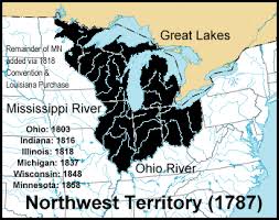
Columbia Tusculum is the oldest neighborhood in the City of Cincinnati, and the second oldest white settlement in the Northwest Territory. The Northwest Territory was founded in 1787, and included what would become the states of Ohio, Indiana, Illinois, Michigan, Wisconsin, and part of Minnesota. Its formal name was the Territory Northwest of the Ohio River.
Map of the Northwest Territory
The Disappearing Horses
White people settled what is now Columbia Tusculum in the late 1700s. A guy named Benjamin Stites from Pennsylvania was on a hunting expedition in Kentucky when a group of Native People made off with his horses. Stites followed them but they were gone. However, he decided that the area would be prime real estate for his settlement. He returned to his family in Pennsylvania, and immediately negotiated an agreement with a New Jersey Congressmen named John Cleves Simms. Simms purchased a large piece of land in the newly established Northwest Territory, and sold Stites a 20,000 acre parcel at less than a dollar an acre, near the confluence of the Ohio River and Little Miami River.
Stites gathered a settlement party of 26 people from New Jersey and journeyed west. They anticipated hostility and conflict with Native People, but they encountered none. Although they had heard rumors of 500 Native People waiting for them, everyone arrived safely on the morning of November 18, 1788.
The Stites House today in the Cincinnati neighborhood of Columbia Tusculum.
No One Likes a Sour Vibe
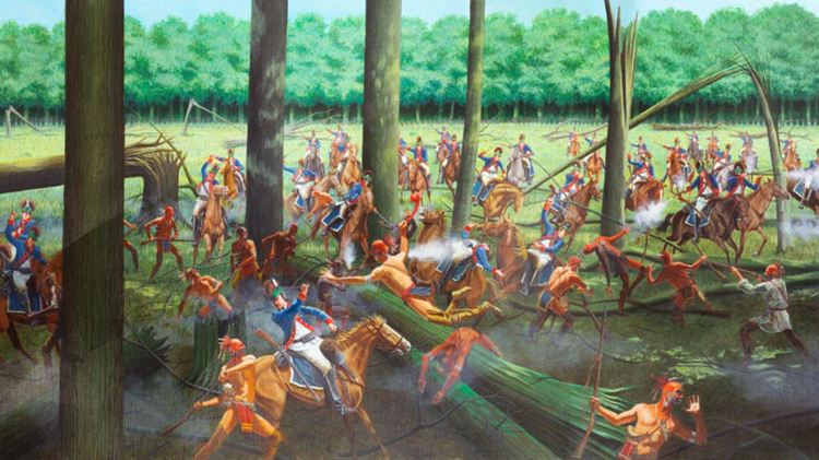
Relations with the Native People were pleasant enough in the very early days of the settlement but they soon turned sour. History records murder and kidnapping of the white settlers, earning the area the dire nickname “Slaughterhouse.” A few years later in 1794, the US army staged the Battle of Fallen Timbers along the Maumee River in Northwest Ohio. This would be the final battle in the Northwest Indian War between the Native People affiliated with the Western Confederacy and the United States. The leaders of the Western Confederacy included Chief Little Turtle of the Miami, Chief Blue Jacket of the Shawnee, Chief Buckongahelas of the Lenape, Chief Egushawa of the Ottawas, and others that history has rendered invisible. At least one tribe, the Chickasaws, fought alongside the US as allies. Although the battle itself was only about an hour, its consequences resulted in the forced displacement of the Native People from what is now the State of Ohio.
Artistic depiction of the Battle of Fallen Timbers from The Chickasaw Nation’s Chickasaw TV Video Network, 2024.
Settling into the 19th Century
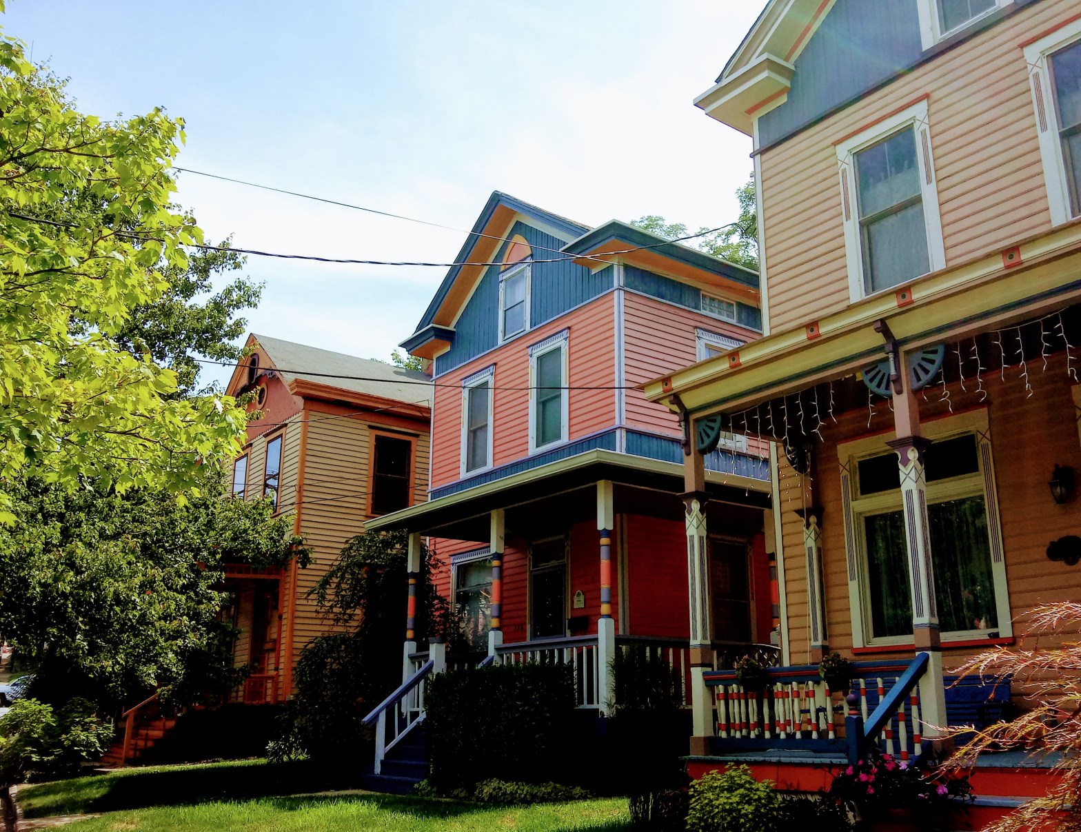
After the victory at the Battle of Fallen Timbers, the white settlers in Columbia Tusculum felt safe to construct their homes with less safety measures. However, as they began to expand their settlement, they realized they were building on a flood plain of the Ohio River. They relocated to the foot of Tusculum Hill in 1815, and most of that existing neighborhood is still around. The oldest home that is still occupied nearly 225 years later is at 3644 Eastern Avenue and was built in 1805. It has evolved over the years, from a modest log cabin to its current style of Gothic Revival. Today, many of the houses in the neighborhood of Columbia Tusculum are on the National Registry of Historic Places, including the rows of “Painted Ladies” that line Tusculum Avenue.
“Painted Ladies” along Tusculum Avenue.
Although the institutions and dominant culture have not fully acknowledged the genocide of the Native People and their forced displacement, the Ohio River Valley and the State of Ohio have made attempts in more modern times to preserve, protect, and share the indigenous history that remains. Within driving distance of the City of Cincinnati are multiple mounds such as Fort Ancient, Indian Mound Reserve, and the well-known Serpent Mound. We can’t change history, but we can raise our awareness, shift our perspective, and compassionately recognize that the land is native land and treat it with love. Participate in landback movements through consciousness and donation. Learn about land acknowledgements and introduce the practice into your spaces and circles. Support indigenous travel and tourism when possible. No more sour vibes.
A blast of chilly air massaged my face, damp with perspiration, as I pushed open the door to a four bed bunk room at the hostel. I was in Puerto Iguazu, Argentina, a small border town on the confluence of the Parana and Iguazu rivers. The late February jungle air hung dense, and I had practically swum through the unpaved streets of the town center. It had been a twenty hour ride on a crowded bus from Buenos Aires, and I was in dirty clothes, the soles of my feet blackened from grime, my stomach aching with hunger. My traveling companion was equally ragged in torn cargo shorts and a face many months unshaven; he had begun to knot the longest tips of his beard into a trio of braids, secured with beads at the ends. Puerto Iguazu was the final remote destination on our journey, and from this point we would return overland to Bogota, 4213 miles to the north.
The comforts at the hostel were a welcomed sight after a 20 hour bus ride from Buenos Aires.
After a brief nap, we used our Steripen to sanitize water, and our hunger then became our primary need. We wandered the plaza, browsing the usual tourist shops selling braided bracelets, freezer magnets, and snow globes with Caucasian-featured figurines holding surfboards. As the gateway town to Iguazu Falls National Park, Puerto Iguazu has developed most of its economic infrastructure around tourism.
After a modest meal of steak and fried yucca root, I followed a trail away from the street cafes and passed modern hotels with valet parking and airport shuttles, to the confluence where the muddy water of the two rivers swirled into ripples and eddies. I was in the Triple Frontier. From this point, I saw three nations: Argentina where I stood, Paraguay across the water on the left bank, and Brazil to the right. VISA requirements prevented me from crossing the borders; the invisible line had been drawn. I had ventured to the farthest edge of my journey.
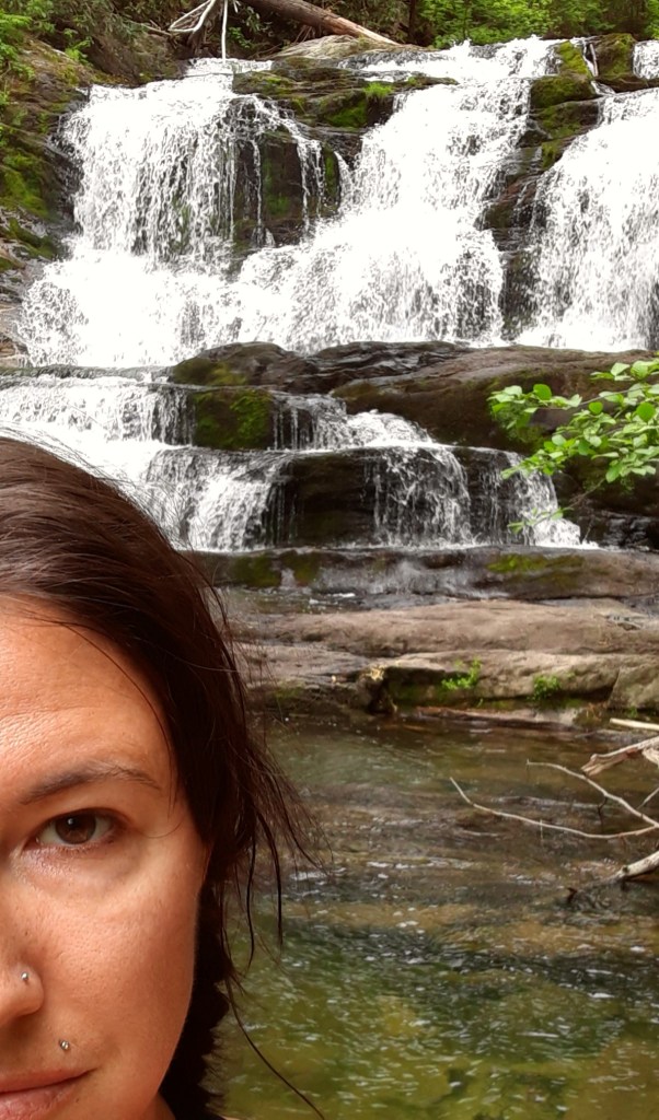
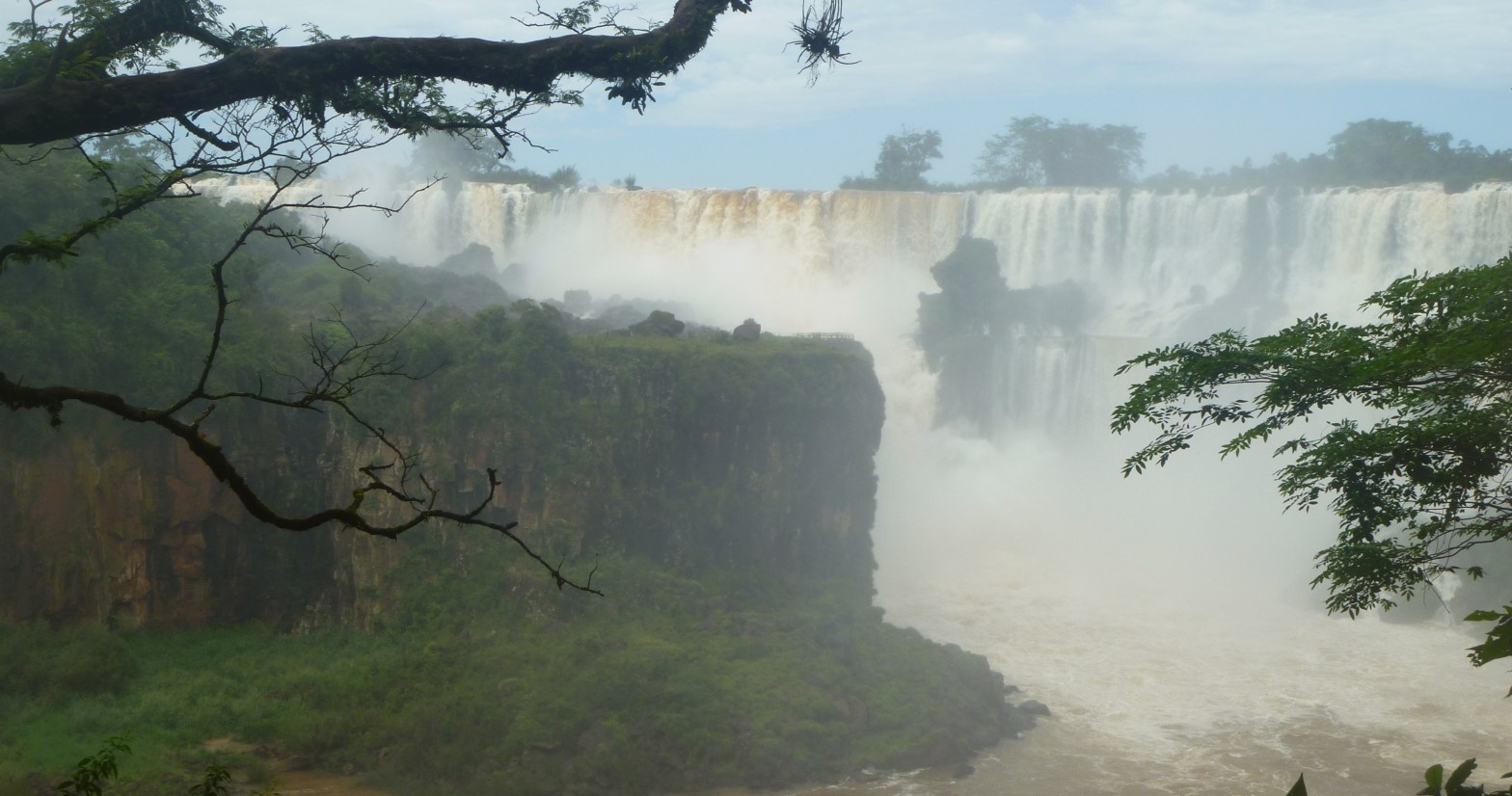
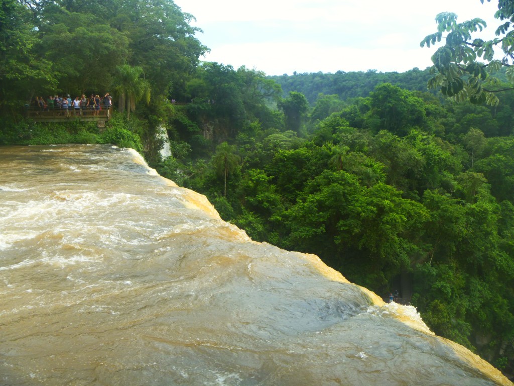
We were there to see Iguazu Falls, an UNESCO World Heritage Site and one of the Seven Wonders of the Natural World. “Iguazu” means “many waters” in the local indigenous language of Tupi-Guarani. True to its name, Iguazu Falls is a collection of 275 individual falls that roll through the heart of the Paranaense Rainforest, making it the largest waterfall system on Earth. The most monumental falls is the Devil’s Throat Falls, where the water tumbles deafeningly into a canyon 80 meters deep.
Iguaze Falls was inscribed as a World Heritage Site in 1984, and is one of the Seven Wonders of the Natural World. Iguazu means “many waters” in the local indigenous language of Tupi-Guarani.
Waterfalls produce an abundance of what are called “negative ions.” Negative ions are healthy for our bodies, contrary to what it might seem with the use of the word “negative.” Ions have an electrical charge that is either positive or negative. Positively charged ions have lost one or more electrons, while negatively charged ions are oxygen atoms with a large number of negatively charged electrons. These two types of ions are fundamentally different in their sub-atomic structure. Negatively charged ions can be found in natural areas, such as on beaches, near waterfalls, and in the forest after a lightning storm. They increase a sense of calm and well-being.
Waterfalls are also spiritually symbolic. They represent the process of release, of letting go; they are the continuous flow of life and energy reminding us that no moment in time is the same as the one before it. Each breath, each heartbeat, each blink is a space of awakening into a new experience that invites vitality, awareness, and strength.
At the Devil’s Throat, the water drops into a canyon 80 meters deep.
Once in the park, we followed a narrow boardwalk over several of the smaller falls toward the Devil’s Throat. A dim roar rumbled amidst the dense jungle, and the walkway quivered slightly beneath our feet. We carved a path to the fence separating the crowd from the rush of water that churned relentlessly toward its inevitable fall into vapor. After four months wandering through South America, it was easy to imagine we had reached a final nexus point with a future as unimaginable and unseen as whatever was beneath the mist that poured toward the sky from the depth of the canyon. The life we had left in Sacramento was upstream, my work in humanitarian aid and disaster response, his work in death care services, and our shared world of weekend camping trips to the hot springs and Redwood forest; whatever we would create from this point was as fresh and unknowable as the mouth of the Parana River that emptied downstream into the Atlantic Ocean, on the other side of this watery abyss. We shared a snack of roasted cashews and dried fruit, observing a space of silence to hear messages from the falls, and gazed at the edge of the world.
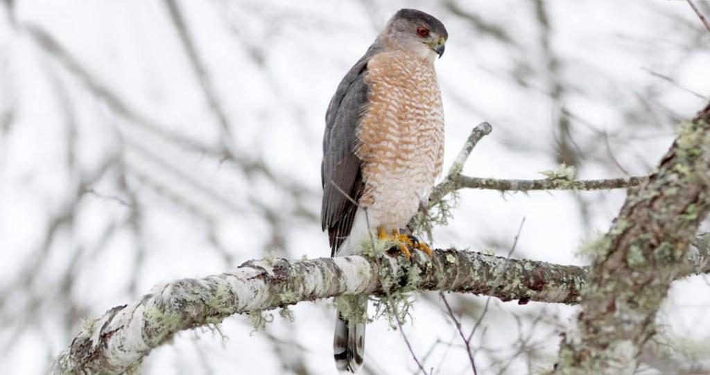
A new subdivision is being constructed across the street from where I am currently living. Two years ago, this had been a woodland meadow of grass and wildflowers. Often on my walks, I had noticed Cooper’s Hawks circling and hunting overhead. Construction began last spring, transforming the prairie into a field of mud as the trees and vegetation were stripped and leveled. The summer brought a din of construction trucks that pushed clouds of dust into the air, transforming the natural grassland habitat into a cul-de-sac-sans-sidewalk of maybe three single family homes. For a few weeks, the hawks circled in larger numbers as their competition for food increased, and then I no longer saw them. They had moved on.
Cooper’s Hawks
Cooper’s Hawks are one of several year-round birds who essentially “shelter in place” through winter months in the Ohio River Valley. Other species are the robin, goldfinch, barred owl, carolina wren, the bluebird, the cardinal, and the downy woodpecker. With its moderately temperature winter climate, the area also hosts birds from more northern regions like the tree sparrow, bald eagle, great horned owl, winter wren, and the brown creeper. Scientists estimate that the bioregion in winter is home to at least 150 species of birds.
These year-round winged friends are pretty important for our ecosystem services. Ecosystem services refers to all the benefits that nature provides, like how the trees produce oxygen and sequester carbon; how the marshlands filter water; and how some plants convert sunlight into energy for food, and how others convert sunlight into energy for medicine. It’s a term that the capitalists developed to quantify the value of nature in a dollar-driven language, and I see use for the term because it does frame our human activity within a language that indicates a relationship with nature and not outside of it. It places us within the web of life.
Our winged friends contribute to this web of life through many roles. They are predators, pollinators, scavengers, and engineers. They help plants reproduce and diversity, they disperse seeds and restore ecosystems, and they mitigate disease by clearing carcasses. If they disappeared from the planet or if their number were to significantly decrease, we would first notice a distinct decline in global reforestation and plant regeneration rates.
One way to create a good relationship with these beings is to help them out in the winter with some additional seeds. Birds have a lot to contend with for survival, between habitat loss, the avian flu, and frigid temperatures. According to the Aldo Leopold Foundation, birds with access to seeds during winter have an increased chance at staying alive through extreme cold spells, and improved reproduction in the spring.
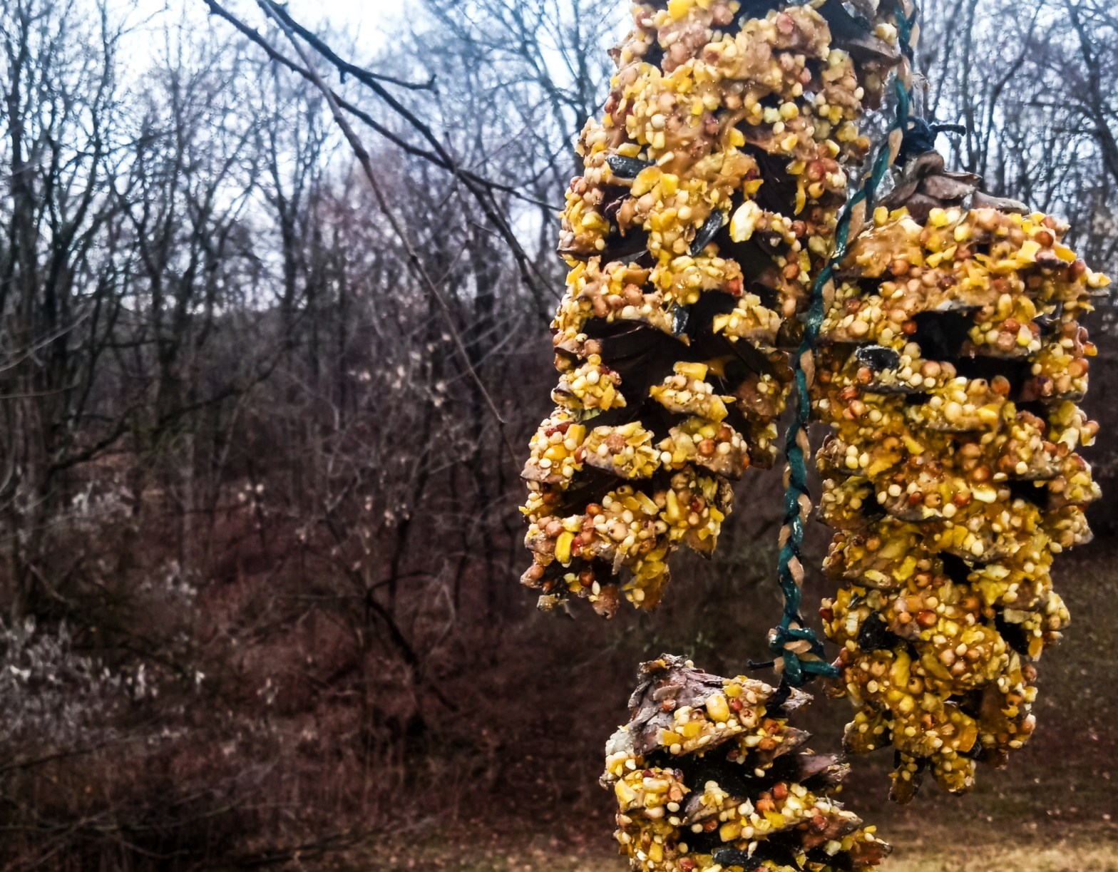
Pine cones, peanut butter, and bird seed with a braided hemp rope to hang the completed feeder from a tree branch.
Pine cone bird feeders are an easy and accessible option that uses all natural materials to create a food source. The first step is to collect pine cones, then all you need is bird seed and peanut butter. Add a decorative weave to secure the pine cones to a branch, and you’ve got helpful eco-art. Some seeds are more preferred over others. Look for mixes with black-oil sunflower seeds, cracked corn, and peanuts. Don’t feed any birds bread or popcorn.
Energetic enhancement for the completed feeders with a mantra and amethyst stone.
Add a mantra to enhance their energy vibe. I use Lokah Samastah Sukhino Bhavantu, which translates from Sanskrit to English as “May all beings everywhere be happy and free, and may the thoughts, words, and actions of my own life contribute in some way to that happiness and that freedom for all.” Small actions can produce deep results.
The completed bird feeder eco-art. Pine cones, peanut butter, bird seed hanging on a braid of woven hemp.
Founded during the peak of the American Spiritualist movement in the mid-19th century, Cassadaga, Florida, is now a US Historic District and continues to host the Southern Cassadaga Spiritualist Camp for seekers, psychics, and mediums to explore the veil between our world and the “others.”
Spiritualists essentially believe that living humans can successfully interact with the personalities of deceased humans and other entities through practices such as channeling and divination. These spirits and entities offer insight and guidance to living humans, and help us along our own path. Psychics and mediums use tools like mirrors, tarot cards, palmistry, spirit boards, and bowls of water to manifest the messages from these non-human entities, since the entities don’t have physical bodies and don’t inhabit exactly the same physical space that we do. It is believed that psychic and medium skills are either a natural occurrence in some people, like athleticism or singing, while other people acquire the skill through a traumatic life event. George Colby, the founder of the Cassadaga Spiritualist Camp, earned his talent after surviving a baptism in freezing lake water.
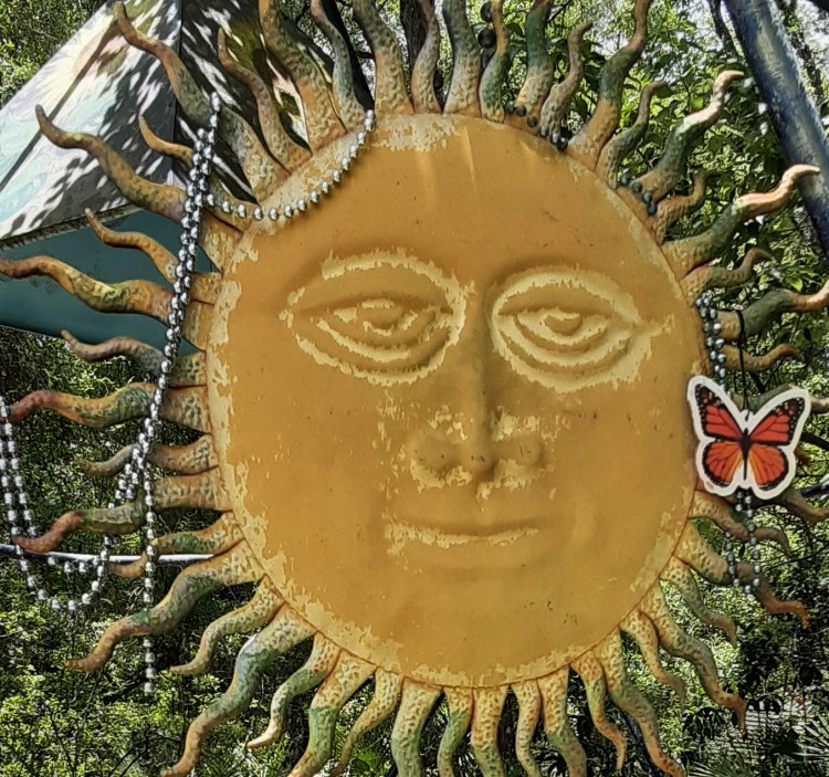
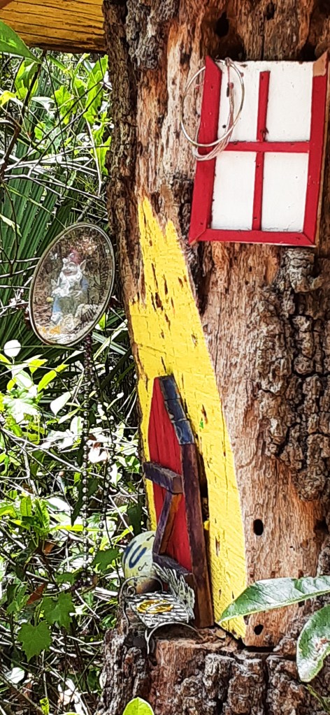
I stopped in Cassadaga for a quick lunch while traveling north toward the Georgia coast. Non-human entities contact me without the assistance of psychics and mediums, so I wasn’t interested in handing over $70 for a 30-minute reading of my Akashic records. However, I had heard of a footpath called the Fairy Trail, and after a quick meal of canned dolmas and a fresh mango, I ventured toward Horseshoe Park and the trail head.
Gnome house along the Fairy Trail.
The most popular spot along the Fairy Trail is a set of human-size fairy wings, painted onto wood and mounted in a way for someone to take a picture of themselves with the wings behind them. As a solo-traveler without a selfie-stick, I bypassed the photo opp and decided to take a quick look around the other attractions in the village. Before long, I stumbled into the C. Green’s Haunted History Museum, which promised access to obscure items, antiquities of the spiritualist movement, and hauntings. How could I resist?
Once inside, the Museum is packed with all that it promised. The space is a crowded foyer with a long and narrow hallway extending toward a final room. I had followed a group of three others inside, and the four of us were the only visitors. I saw newspaper clippings of the history of Cassadaga, of Bigfoot and alien sightings, of mysteries and murders solved through mediumship, and of ghostly possessions that ended in tragedy. Dolls and toys that played host to malevolent beings stared out at us through glass cases, while spirit boards, crystal balls, and scrying mirrors shimmered in the low light. As we approached the final darkened room, I held back to allow the other group to enter first, while I examined post-mortem photographs of Victorian children in stiff knickers and Christening gowns. The group of three exited the last room, and I stepped forward to enter. Immediately, I felt a pounding sensation in my head and a total darkness covered my vision. Whatever was in that room didn’t want me there. Nope. I turned immediately and followed the group out the door.
After exiting the museum, I asked the Curator about that last room. She said it held artifacts from Area 51. I asked what else was in the room. She confirmed that the ghost of a very unhappy man who had lived and worked in that room when it used to be the village post office continued to hold onto the space. Upon hearing this, I couldn’t help but wonder why stay attached to the discomfort of human suffering once our spirit is liberated from the human body? Maybe that’s why “ghosts” tend to be an unpleasant type of non-human entity, unlike the more beneficial and benevolent guides.
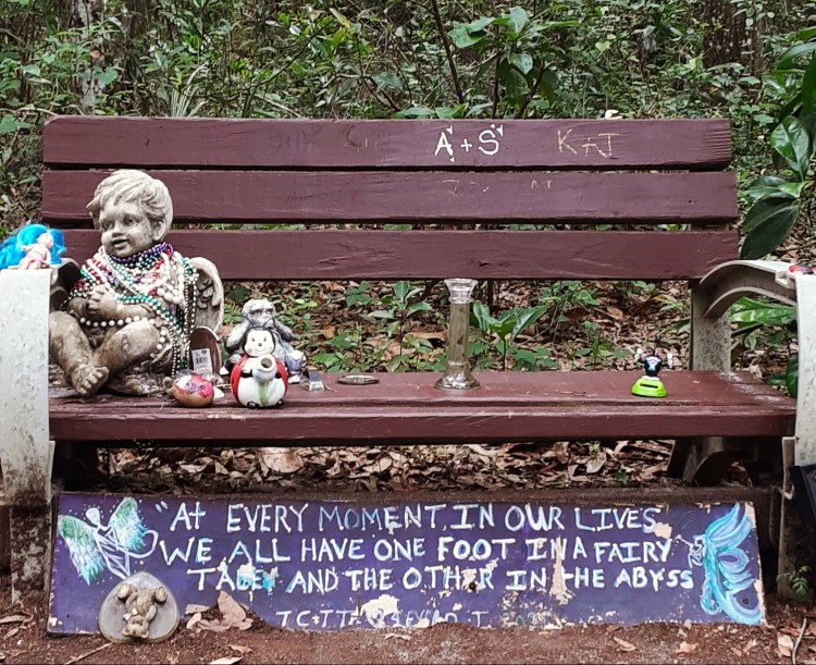
Bench along the Fairy Trail.
Cassadaga is a quaint reminder of the mysteries of death and mortality. Whether or not a visitor “believes” in or experiences the enchanted and supernatural world of the Spiritualists, each of us will one day cross the threshold into the spirit world. As is painted on a bench along the Fairy Trail, “we all have one foot in a fairy tale, and the other in the abyss.” We see this reality in nature, as the seasons change, within the folds of the food web, and even in our own bodies. Developing a relationship with nature allows us to feel more comfortable and to have more faith in that liminal space of transience; through a gentle acceptance of impermanence, we can meander gracefully along our path with one foot toward the dream of our life, and the other toward the unknown eternity.
Thirteen percent of the land in the United States is protected from development, which is one-tenth of the total protected land on the planet. These areas are managed under the National Park Service, the United States Forest Service, the Bureau of Land Management, and the United States Fish and Wildlife Service. State by state, even more land is protected through individual state governments.
Many of these areas offer accessible, paved trails; amenities such as bathrooms and even hot showers; and interpretive hikes with rangers. This post provides three ideas for low-impact, budget-friendly eco-adventures in the American southeast. The downside is that a personal vehicle is required. Bus routes are non-existent, and the destinations are remote enough that hitchhiking or trekking in from a nearby town are not practical options. However, what’s more synonymous with America than a road trip?
Hiking DeSoto Falls
Located deep in northern Georgia’s Blue Ridge Mountains and the Chattahoochee National Forest are DeSoto Falls. A 2.4 mile rugged trail along Frogtown Creek connects hikers to the Upper Falls, Middle Falls, and Lower Falls. The Upper Falls are the most scenic, with a 200-foot drop and a wooden viewing platforms with seating to rest and observe the sunlight filtering through the dense forest of old-growth pine and vibrant rhododendrons. The video below is an 11-second clip of the majestic Upper Falls.
De Soto Falls, Blue Ridge Mountains of Georgia
Although AllTrails lists DeSoto Falls Trail as “heavily trafficked,” I was the only person on the trail during my visit. The sky had dumped buckets of rain on the forest the night before my hike, and the cascades were alive with movement. I paid the price of comfort for the solitude though, as I had been camping nearby and discovered during the overnight storm that my tent is only relatively waterproof.
Rain, and any weather pattern, is part of the eco-system, and without a cold and wet night digging moats to direct the flow of water away from the base of my tent, I would not have seen such vibrant waterfalls, or the lush and nearly jungle-feel of the surrounding forest. Besides, waterfalls are good for health. Check out my post on Waterfalling to learn more about the demonstrated health benefits of hanging out near a waterfall.
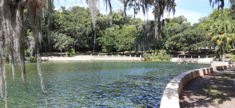
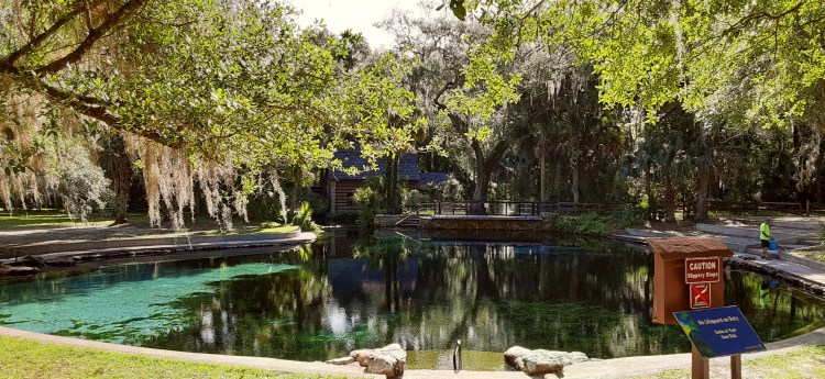
Swimming in Natural Springs in the Ocala National Forest
Florida’s Ocala National Forest is one of the most unique eco-systems on the planet. The area is home to the largest concentration of sand pine in the world. In 1908, President Theodore Roosevelt formally established the National Forest, and today it is 607 square miles of conifer, sand pine, and long leaf pine woodlands, with four crystal-clear and inviting natural springs for swimming and meditation.
Juniper Springs is located inside a large recreation area, and was rather crowded when I arrived late in the afternoon on a hot and sunny Sunday afternoon. However, the weekend groups thinned out, and the pool was completely empty when I awoke and walked to the pool from my campsite. Another woman was nearby doing yoga and a park employee was preparing the site for the day, but otherwise the space was mine.
The water at Juniper Springs is a constant 68-72 degrees, which is definitely chilly. Although the bottom is deceptively visible, the pool is 21 feet deep. I am a good swimmer, but afraid of deep water for some reason, and took the opportunity to confront that fear with several laps around the pool.
Juniper Springs, Ocala National Forest
Swimming in cold water is good for health. It boosts white blood cell counts, and flushes veins, arteries, and capillaries. It also activates endorphins, and supports estrogen and testosterone production. Finally, it burns more calories than swimming in warmer water, as the body tries to keep itself warm.
After about 20 minutes in the water alone, the woman doing yoga joined me. She and her male partner both worked for a California-based tech company and had been remote for over a year, living and working from their RV. She told me about Salt Springs, and since it was on the way toward my next destination, I decided to visit that one as well.
Arriving at Salt Springs felt like I had discovered an ancient secret. The infrastructure was clean, welcoming, accessible, and developed, but hardly anyone was there. The pool at Salt Spring is much larger than Juniper Spring, and it is shallower so the water is warmer. A tall mosaic wall surrounds the pool, and I secured a spot in the sun with a roomy distance between a group of young boys snorkeling in the shallows, and a woman reading a novel. I felt very connected to the earth and water spirits at that location. The video below is a 25-second clip of one of my swims into Salt Spring.
I was relieved that the springs I visited had not been ruined with over-crowding and over-use. If planning to visit these springs, or any natural area, please remember to pack everything out. One easy way to do that is to minimize the amount you are packing in. Identify everything you might want to take with you, and then remove half of it. We need less than we think.
Biking Cumberland Island National Seashore
Cumberland Island is located about 11 miles off the coast of Georgia. It is only accessible on a ferry from the town of St. Marys. Unfortunately, affordable lodging is scarce in St. Marys, and the only nearby camping is an RV park at the Crooked River State Park. I bunked in my tent among roaring generators and nosy neighbors the night before my day-journey to Cumberland Island, and almost cancelled the entire endeavor. However, I followed through on my plans and the experience was one of my most memorable adventures in the past year and a half.
The ferry ride is about 45-minutes over smooth waters. Upon arriving at Cumberland Island, it docks twice. Most passengers de-board at the first dock, the Ice House Museum, to explore the Dungeness Ruins and the historical cemetery, and to walk the Interdune Boardwalk and across Dungeness Beach. The Southend Loop walk takes about 3-4 hours, and allows visitors to see and experience the island’s natural and cultural landscapes. The video below is a short clip of the ferry docking at the Ice House Museum.
I stayed on the ferry to de-board at the more remote Sea Camp Rancher Station. This is the stop for backcountry campers, and for those of us renting bikes for the day. My bike rental was $18, and I set off north on the Main Road. I had wanted to reach the northernmost point of the road to see the Cumberland Wharf Ruins, which would take me through many miles of wilderness area, but of course that plan was overly ambitious.
First, the Main Road is an unpaved sand and gravel trail that turns progressively more rugged once I entered the wilderness area. At some points, I had to get off the bike and push it through sand that was deeper than the depth of the tire. Second, water is scarce and although the map indicated potable water at Plum Orchard around mile eight, it had not gotten turned off during shut down and there wasn’t actually any water. Third, I had drastically underestimated the mileage to the Cumberland Wharf Ruins, and how long it would take for me to travel that distance on a beach cruiser across the sandy path. In total, I biked about twenty miles, and returned to St. Marys on the evening ferry, dehydrated and sunburned.
The “main road” on Cumberland Island.
It was worth the effort. The eco-system of the wilderness area was like something out of Jurassic Park. Herds of wild horses meandered across beach prairies, armadillos munched calmly on leafy vegetation along the path, flocks of fat turkeys pecked at insects in the trees, and a green-eyes bobcat sheltered in the shade of a large fern leaf while an oppressive afternoon sun tore through the forest canopy. Riding a bike in these conditions isn’t for everyone though. It was definitely difficult and somewhat painful, but the wild horses and armadillos are also often sighted near the Ice House Museum and the Dungeness Ruins.
Do you like what you see and want to get more tips, insights, and ideas for your next low-impact eco-adventure? Follow Nomad Star Travel to stay current.